Follow me on my trip in a Cessna 152 across the wonders of the American West.

Flying the Desert En français s'il vous plaît...

You can wait for the clickable map below to download (92 KB)
or click here to begin from the first leg of the trip, or return to the introduction.

Be sure to check Santa Catalina, SantaYnez and Sedona. These legs have the best pictures!

Clickable map of the trip - too bad you can't see it !

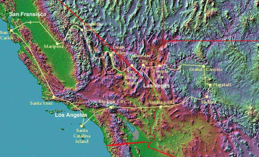
Clickable map of the trip (92 kb).
This picture was compiled from material downloaded from the Johns Hopkins University Applied Physics Lab. The original is a topographical  map of California, Nevada, Arizona and Utah compiled by Ray Sterner.  The water is colored blue, but the other colors indicate altitude, not the actual ground color. The route of trip is coloured yellow and state frontiers are red. The yellow dots represent airports.


Drop me a note !

Return to Flying the Desert

Return to François Micheloud's Homepage